Geoscience intelligence · Cloud engineering

Terracode Analytics Limited

Terracode combines geoscience, software, and cloud infrastructure to turn complex survey data into reviewable technical work.

01 — The system

One company.
Three ways into the work.

01 · GAIA

Geophysical processing

Structured workflows for magnetic, resistivity, IP, GPR, radiometric, seismic, and related methods.

02 · G-Orchestrate

Project operations

A connected operational view from survey planning through technical delivery and client handoff.

03 · Developer APIs

Cloud processing infrastructure

Scoped access to G-MAG, Quest, G-RES, and TerraPulse through one controlled gateway.

02 — Designed around evidence

Technical work should show its reasoning.

Terracode keeps processing choices, project context, review points, and deliverables connected. The result is easier to inspect, easier to explain, and easier to continue.

Survey evidence moving through connected review layersA field profile passes through quality review, processing, interpretation and a final technical record.FIELDQCPROCESSREVIEWEVIDENCE RETAINED ACROSS THE TECHNICAL RECORD

Start with the problem

Have a difficult dataset, field workflow, or systems problem?

Geoscience intelligence + cloud engineering

From field data to defensible decisions.

Terracode connects geophysical processing, interpretation, reporting, and project operations in one traceable path—so technical teams can move faster without losing scientific context.

Conceptual subsurface model · not live survey output
One connected operating layer

Science in context. Operations in view.

01 / GAIA

Process and interpret geophysical data

Method-specific workflows bring structure to processing, interpretation, validation, and reporting.

Explore GAIA
02 / OPS

Coordinate the full project lifecycle

G-Orchestrate keeps planning, field activity, technical delivery, and stakeholder visibility connected.

See G-Orchestrate
03 / API

Bring production engines into your systems

Scoped developer access connects approved workflows across G-MAG, Quest, G-RES, and TerraPulse.

View developer APIs
Start with the real constraint

What is slowing your geoscience workflow down?

Tell us where the handoff breaks—from acquisition and processing to reporting or delivery—and we will map the right Terracode path.

Geophysical Intelligence System

Clean systems for geophysical decisions.

Terracode builds the data automation and predictive modelling layer that lets technical teams execute faster — and lets stakeholders see project outcomes clearly.

14GAIA Methods
6Lifecycle Stages
5Access Paths
System Index — 02 ProductsLive
14
GAIA Processing Methods
6
Project Lifecycle Stages
5
Access Paths
[ 01 ]The Terracode System

Two products, one operating system

GAIA handles geophysical processing with method-level precision. G-Orchestrate wraps the full project lifecycle — from planning through delivery.

Processing Engine · Technical teams

GAIA

Unified processing engine for geophysical analysis with a method-based execution model.

  • Structured processing pipeline
  • Method-by-method workflow structure
  • Aurora AI reports and predictive modelling
See GAIA methods
Enterprise Platform · Organizations

G-Orchestrate

Workflow orchestration layer giving organizations full project visibility from pre-field through delivery.

  • Operational transparency across teams
  • Lifecycle-aware project coordination
  • Enterprise inquiry and solution design
Request enterprise inquiry
[ 02 ]Services

Expert support alongside the platform

When teams need geophysical execution support or custom tooling, Terracode provides both — built on the same workflow logic as GAIA and G-Orchestrate.

SVC / 01

Geophysical services

Data acquisition, processing, interpretation, and full lifecycle delivery support.

SVC / 02

Custom application building

Workflow systems, geophysical tools, and integrations tailored to your operating environment.

Tell us your current operational bottleneck and we will map the right path.

Start now

Ready to bring structure to your geophysical operations?

GAIA method access, G-Orchestrate enterprise discussions, and services support are available through inquiry.

GAIA · Geophysical intelligence

One environment for all methods.

GAIA gives each geophysical method a disciplined processing path while keeping review, interpretation, and reporting connected.

01 — Choose a method workflow

Start with the survey you have.

Select a method to see its supported access path. Available workflows remain explicit; planned methods are not presented as live.

Need help identifying the right method path?

GAIA · Unified Engine

One engine, multiple geophysical methods

GAIA is the unified execution layer for geophysical processing methods, built for structured analysis, interpretation, and reporting workflows.

[ 01 ]Method Index

Choose the method workflow you need

GAIA organizes geophysical processing into clear method paths so teams can request the right access for their survey and interpretation needs.

[ 02 ]GAIA Outcome

What GAIA enables for teams

GAIA helps teams move from fragmented processing to a structured method workflow — consistent outputs, clearer interpretation, reliable handoff into reporting.

OUT / 01

Method consistency

Every method follows controlled processing steps so technical results remain reproducible and auditable.

OUT / 02

Decision readiness

Outputs are generated in a format that supports faster technical review and cleaner transition into reports.

Tell us the method you need and we will route your access request to the right Terracode team.

G-Orchestrate · Project operations

Geophysical operations, structured and fully visible.

A project operating layer that connects planning, field teams, technical work, review, and delivery without reducing the science to a task list.

Geophysical project operations mapSix connected project stages flow around a central project record, with review and delivery paths visible.PLANFIELDPROCESSINTERPRETREVIEWDELIVERPROJECTRECORD
01 — The operating problem

The work is connected.
The tools usually are not.

01

Know what is happening

See stage, owner, dependency, and technical output without assembling status manually.

02

Keep context with the work

Link field evidence and processing artifacts to the stage and decision they support.

03

Make review explicit

Separate completion from approval so clients and technical leads know what is ready.

Map G-Orchestrate to your actual operating environment.

Enterprise discussions begin with the workflow you already run, the people who own it, and the handoffs that currently break.

Enterprise System

Geophysical operations, structured and fully visible

G-Orchestrate connects planning, field operations, processing, and reporting into one system — giving teams and clients full visibility across every project stage.

[ 01 ]The Problem

Why teams struggle without orchestration

Disconnected workflows create execution gaps. Managers can't see real-time status. Projects run on manual follow-up instead of structured process.

PRB / 01

Fragmented workflows

Pre-field, processing, and reporting are disconnected — creating execution gaps at every handoff.

PRB / 02

No visibility

Managers and clients can't see complete real-time project status, leading to late discovery of delays.

PRB / 03

Manual coordination

Project momentum depends on constant human follow-up instead of structured process flow.

[ 02 ]How It Works

One system across the full project lifecycle

Six stages, one connected operating system — from first planning to client delivery.

01
Pre-field
02
Field ops
03
Processing
04
Interpretation
05
Reporting
06
Client delivery
[ 03 ]Core Capabilities

Workflow, visibility, automation

CAP / 01

Workflow orchestration

Tasks and phases connected in a defined sequence that drives execution, not just documentation.

CAP / 02

Real-time tracking

Internal teams and leadership view project state continuously, eliminating blind spots.

CAP / 03

Data and output management

Processing outputs and reports tracked and linked to each project stage.

CAP / 04

GAIA integration

Processing runs through GAIA as part of one connected operating system — not isolated tools.

[ 04 ]Transparency

Internal alignment and external trust

TRN / 01

Internal

Teams stay aligned, managers stay informed, decisions happen faster with fewer surprises.

TRN / 02

External

Clients access progress and deliverables directly — reducing communication friction at every stage.

Request an enterprise discussion to map G-Orchestrate to your operating environment.

Technical services

Expertise for the work that software alone cannot finish.

Field support, geophysical processing, interpretation, delivery, and custom cloud systems—assembled around the real project rather than a fixed package.

01 — Geoscience
Field

Acquisition support

Survey planning, field coordination, method-specific acquisition support, and quality review before the dataset enters processing.

Technical

Processing and interpretation

Corrections, inversion, spatial products, interpretation support, and transparent review through the applicable production workflow.

Delivery

Reports and technical handoff

Reviewable outputs and reporting packages prepared for the people who need to make or defend the next decision.

02 — Cloud engineering

Build the system around the operation.

When an existing product cannot match the workflow, Terracode designs focused applications, integrations, and processing gateways without inventing fake controls or parallel data silos.

  • Operational workflow applications
  • Geophysical processing tools
  • Cloud integrations and API gateways
  • Review, reporting, and delivery systems

Bring us the bottleneck, not a polished brief.

Services

Geophysical expertise and custom systems

Terracode supports organizations with geophysical services and custom-built systems — ensuring workflows are structured from data acquisition through delivery.

[ 02 ]Geophysical Services

Execution support across project delivery

GEO / 01

Data acquisition support

Survey planning, field coordination, and acquisition workflow support.

GEO / 02

Processing and interpretation

Corrections, processing, and interpretation in structured pipelines aligned with GAIA logic.

GEO / 03

Project delivery

Lifecycle delivery from data to final report outputs.

[ 03 ]Custom Application Building

Tailored systems for operational teams

APP / 01

Workflow systems

Internal tracking, dashboards, and coordination layers for project teams.

APP / 02

Geophysical applications

Custom tools for specific geophysical processing and operational needs.

APP / 03

Integrations

Connect current systems and data streams into a cleaner execution environment.

Blog

Platform notes and field thinking

Insights, product updates, and workflow thinking from the Terracode team.

No posts published yet

Field notes and platform updates will appear here.

Blog Article

Terracode article

Loading article…

Contact

Choose your inquiry path

GAIA access, G-Orchestrate enterprise discussions, services inquiry, or general questions — we'll route your message to the right person.

Step 1 of 3
  1. 1Inquiry
  2. 2Details
  3. 3Review
What can we help with?

Choose the route closest to your work. We will direct it to the right team.

Contact details

GAIA
Method access inquiries are routed by selected workflow.
Enterprise
G-Orchestrate enterprise inquiries open now.
Services
Geophysical and custom development inquiries welcome.

Terracode Developer Gateway

Earth-processing infrastructure for your own software.

Create scoped API keys, submit durable jobs, track usage, and retrieve production outputs across four Terracode engines.

A developer request moving through a controlled geoscience gatewayAn API request enters a scoped key gateway and branches to magnetic, spatial, resistivity and radar processing engines.POST /jobsx-api-key: tc_•••operation:"process"status:"queued"result:"reviewable"G-MAGQUESTG-RESTERRAPULSE
01 — Production engines

One access system.
Four technical domains.

Each API page documents the scientific scope honestly. The gateway controls authentication, quotas, durable work, and usage without exposing internal service credentials.

01 · Magnetics

G-MAG

Field correction, IGRF removal, separation, anomaly zoning, and half-width depth.

  • Diurnal correction
  • IGRF removal
  • Depth estimation
Available
02 · Spatial processing

Quest

Magnetic, radiometric, terrain, and GIS products generated through scoped durable jobs.

  • Magnetic products
  • Radiometric products
  • Terrain and GIS
Available
03 · Electrical methods

G-RES

Electrical and induced-polarization processing with reviewable geoelectric sections.

  • VES
  • 2D ERT
  • TDIP and ERT + IP
Available
04 · Ground-penetrating radar

TerraPulse

Deterministic survey-archive and profile processing with protected result artifacts.

  • Archive processing
  • Profile processing
  • Artifact retrieval
Available

Ready to issue a scoped key?

Developer Portal

Build with Terracode processing APIs

Generate real API keys for controlled access to G-MAG, Quest, G-RES, and TerraPulse processing workflows, with durable jobs, flexible quotas, usage tracking, and legal acceptance.

[ 01 ]API Products

Four engines behind one developer key system

G-MAG / Magnetics

Correction and interpretation workflow

Diurnal correction, IGRF removal, regional/residual separation, residual anomaly zone picking, half-width depth calculation, job submission, status polling, and usage tracking.

Quest / Processing engine

Magnetic, radiometric, terrain, and GIS generation

Gridding, TMI, RTP/RTE, FVD, THG, analytic signal, tilt derivative, Euler outputs, K/eU/eTh and ternary, terrain products, and GIS generators through scoped jobs.

G-RES
G-RES / Resistivity & IP

VES, 2D ERT and TDIP processing

Production VES, 2D ERT and time-domain IP inversion, including IP-primary and paired 2D ERT + IP results and reviewed independent-1D VES GeoElectric Sections.

TerraPulse
TerraPulse / GPR

Deterministic GPR processing

Validated multi-vendor GPR archive and profile ingestion (MALA, GSSI, Sensors & Software, ImpulseRadar, IDS), acquisition QC, trace processing, radargram rendering, and protected scientific artifacts.

All APIs

TerraPulse · Ground-penetrating radar

Deterministic GPR processing through a protected gateway.

Process complete survey archives or individual profiles from supported instrument formats while retaining acquisition QC, exact provenance, and protected artifacts.

Supported operations
gpr_archive_processing

Survey archive processing

Validate and process supportable lines as one durable batch.

gpr_profile_processing

Profile processing

Process one supported, matched vendor profile package with reviewable evidence.

Developer Portal / TerraPulse

TerraPulse developer API

Process complete GPR survey archives or individual profile file sets from MALA, GSSI, Sensors & Software, ImpulseRadar, or IDS through TerraPulse's deterministic production pipeline.

GPR / 01

Archive processing

Upload a ZIP survey package, validate every profile, run acquisition QC and process all supportable lines as one durable batch.

GPR / 02

Profile processing

Upload one matched profile package for MALA (.rad + .rd7/.rd3), GSSI (.dzt), Sensors & Software (.dt1 + .hd), ImpulseRadar (.iprb + .iprh), or IDS (.dt).

GPR / 03

Evidence and artifacts

Receive QC, exact processing provenance, time-or-depth axis metadata, processed arrays, summaries, and radargram images without automated interpretation claims.

Operations: gpr_archive_processing, gpr_profile_processing.

All APIs

G-RES · Resistivity and induced polarization

Electrical geophysics, exposed with its technical limits intact.

Submit VES, 2D ERT, TDIP, paired ERT + IP, and reviewed independent-1D geoelectric-section work through the production G-RES contract.

Supported operations
ves_inversion

Independent 1D VES

Invert a vertical electrical sounding through the production engine.

ert_2d_inversion

2D ERT

Run the validated 2.5D DC resistivity inversion contract.

tdip_2d_inversion

Time-domain IP

Run chargeability-primary TDIP through the validated scientific path.

ert_tdip_2d_inversion

Paired ERT + IP

Return synchronized resistivity and chargeability results from one dataset.

ves_geoelectric_section

Reviewed VES correlation

Correlate reviewed independent 1D models; this is not a 2D inversion.

Developer Portal / G-RES

G-RES developer API

Run the same production resistivity and time-domain induced-polarization workflows used by the G-RES application.

GRES / 01

VES inversion

Invert an independent 1D VES sounding with the production G-RES inversion engine.

GRES / 02

2D ERT inversion

Run the production 2.5D DC resistivity inversion contract.

GRES / 03

TDIP and paired ERT + IP

Run chargeability-primary TDIP or synchronized DC resistivity and TDIP chargeability processing from the same validated scientific pipeline.

GRES / 04

VES GeoElectric Section

Correlate at least two explicitly reviewed independent 1D VES models. This is not a 2D or laterally constrained inversion.

Operations: ves_inversion, ert_2d_inversion, tdip_2d_inversion, ert_tdip_2d_inversion, ves_geoelectric_section.

All APIs

G-MAG · Magnetic correction and interpretation

Magnetic field processing as small, explicit operations.

Apply production corrections and interpretation helpers through scoped jobs with durable status, usage, and result tracking.

Supported operations
diurnal_correction

Diurnal correction

Remove time-varying magnetic drift from survey observations.

igrf_removal

IGRF removal

Remove the International Geomagnetic Reference Field contribution.

regional_residual_separation

Regional / residual separation

Separate broad background field from local anomaly content.

residual_anomaly_zones

Residual anomaly zones

Identify reviewable profile zones for interpretation.

half_width_depth

Half-width depth

Estimate approximate source depth from profile geometry.

Developer Portal / G-MAG

G-MAG developer API

Expose the production G-MAG magnetic correction and interpretation workflow through scoped developer jobs.

GMAG / 01

Diurnal correction

Apply diurnal magnetic variation correction in the active G-MAG pipeline.

GMAG / 02

IGRF removal

Remove the International Geomagnetic Reference Field contribution.

GMAG / 03

Regional/residual separation

Generate regional and residual magnetic fields from corrected data.

GMAG / 04

Residual anomaly zones

Pick residual anomaly zones for interpretation and review.

GMAG / 05

Half-width depth

Estimate approximate source depth using half-width profile geometry.

API operation ids: diurnal_correction, igrf_removal, regional_residual_separation, residual_anomaly_zones, half_width_depth.

All APIs

Quest · Spatial product generation

From source grids to inspectable geospatial products.

Generate magnetic, radiometric, terrain, and GIS outputs through operation-scoped jobs while keeping internal processing routes protected.

Product families
MAG

Magnetic products

Grids, transformations, derivatives, Euler solutions, clusters, rejected solutions, and targets.

RAD

Radiometry

K, eU, eTh bands and ternary RGB composite generation.

TER

Terrain

DEM, hillshade, slope, contours, drainage, lineaments, density, and intersections.

GIS

GIS analysis

Vector, raster, interpolation, terrain-profile, hotspot, and suitability operations.

Developer Portal / Quest

Quest developer API

Generate magnetic, radiometric, terrain, and GIS products through the Quest processing engine.

MAG / 01

Magnetic products

Gridding, TMI, RTP, RTE, FVD, THG, analytic signal, tilt derivative, Euler solutions, clusters, rejected solutions, and targets.

RAD / 02

Radiometry

K, eU, eTh single-band generation and ternary RGB composite generation.

TER / 03

Terrain

DEM, hillshade, multi-hillshade, slope, contours, drainage network, drainage density, lineaments, density, and intersections.

GIS / 04

GIS analysis

Vector overlays, raster calculator/reclassify/clip/mosaic, interpolation, terrain profiles, hotspot and suitability analysis.

Quest keys are scoped through the Terracode gateway, so raw internal Quest routes are not exposed publicly.

Developer Portal

Terracode Console

Sign in to access your developer workspace.

Developer sign in

Sign in or create an account to open your Terracode developer console.

or

Terracode Analytics
TA
Developer Portal launch gate

API key generation and developer API calls open automatically on launch.

Good day

Overview of your developer account and activity.

Total Projects0
API Requests0
Successful Jobs0
Avg. Processing Time-
T

Projects

Your generated API keys are grouped as projects.

Request API key

Subscription and legal acceptance are confirmed during sign-up.

Recent Activity

Recent API job activity across your account.

Analytics

Usage totals for this developer account.

0Total API Requests
0Total Errors

Products

Explore Terracode developer products available through the gateway.

G-MAG Products

Magnetic correction and interpretation workflow.

Quest Products

Magnetic, radiometric, terrain, and GIS product generation.

G-RES Products

Production resistivity processing with reviewed VES correlation.

TerraPulse Products

Deterministic GPR ingestion, QC, processing, and radargram artifacts.

API Keys

Manage keys used to authenticate Terracode developer API requests.

Total Keys0
K
Active Keys0
A
Revoked Keys0
R
Expiring Soon0
E

Keys

Keys are shown once when created, then stored hashed.

API Key Best Practices

  • Store API keys securely.
  • Never share keys in public repositories.
  • Use environment variables.
  • Revoke unused keys.

Analytics

Track API usage, job activity, and error trends for this account.

Total API Requests0
Q
Successful Jobs0
J
Total Errors0
X
Data Processed-
D

Requests by Product

Usage will populate as your keys submit work.

Recent Alerts

A
No alerts yetOperational alerts will appear here when there is activity to review.
Admin Access

Admin publishing access

Admins can publish blog posts with images, SEO fields, and generative-engine metadata.

Admin sign in

Superadmin Access

Secure control for Terracode operations

The superadmin workspace manages admin invites, blog publishing, and payment-bypass app links.

Superadmin setup

Request a one-time setup link by email if the superadmin account is not yet initialized.

Complete setup

Superadmin sign in

Admin Workspace

Publish Terracode blog content

Signed in user: none

Loading workspace…

New blog post

Create rich posts with image upload, SEO metadata, and GEO fields.

Editing

Published posts

Review and manage existing posts.

Superadmin Workspace

Admin invites, publishing, bypass controls

Signed in user: none

Loading workspace…

Publish blog post

Superadmin posts use the same SEO, GEO, and image workflow.

Editing

Invite an admin

Generate a one-time email invite for a new admin account.

Payment-bypass link

Create an expiring access link for a product and customer email.

Developer API keys

Review developer keys, scopes, usage, and revoke access.

Published posts

Edit, delete, or open any published article.

Developer API Monitoring

Every developer using the Terracode API — keys, requests, jobs, errors, and activity.

Requests by product

Recent activity

Meet the Team

Add roles, update names, control visibility, reorder profiles, and manage photographs shown on the homepage.

JPEG, PNG, or WebP · maximum 5 MB.

Partners

Build the field-to-cloud path with people who own a real part of it.

Terracode partnerships connect instruments, domain expertise, and production software without overstating what has already been integrated.

Sake Innovations iSmart Terrameter
iSmart Terrameter · Sake Innovations & Technologies

Acquisition partner · Nigeria

Sake Innovations

Sake builds the iSmart Terrameter for self-potential, resistivity, induced-polarization, and ERT field acquisition. Terracode provides the current validated CSV handoff into supported G-RES processing workflows.

Current
Validated CSV handoff into G-RES
Roadmap
Direct export, mobile upload, authenticated cloud synchronization

Partnership claims should be as reviewable as technical outputs.

Team

Geoscience, engineering, and delivery in one room.

Terracode is built by a multidisciplinary team working across scientific software, cloud systems, project operations, strategy, and communication.

Portrait of Toluwanimi Adedokun
01

Toluwanimi Adedokun

Chief Executive Officer

Portrait of Marvellous Ibiteye
02

Marvellous Ibiteye

Chief Information Officer

Portrait of Keku Timilehin
03

Keku Timilehin

Chief Technology Officer

Portrait of Kelechi Egbujor
04

Kelechi Egbujor

Senior Project Manager

05

Faith Effong

Head of Strategy and Partnerships

Portrait of Tolani Ayomide
06

Tolani Ayomide

Social Media Manager

Portrait of Favour Adejumo
07

Favour Adejumo

Cloud Engineer

08

Emmanuel Samuel

Junior Geophysical Software and Validation Engineer

Work with the team.

All partners

Terracode × Sake Innovations

Field acquisition meets structured processing.

iSmart captures electrical geophysics in the field. G-RES continues the validated dataset through processing, interpretation, and reporting.

  • Self-potential
  • Resistivity
  • Induced polarization
  • ERT
Current connectionValidated CSV handoff
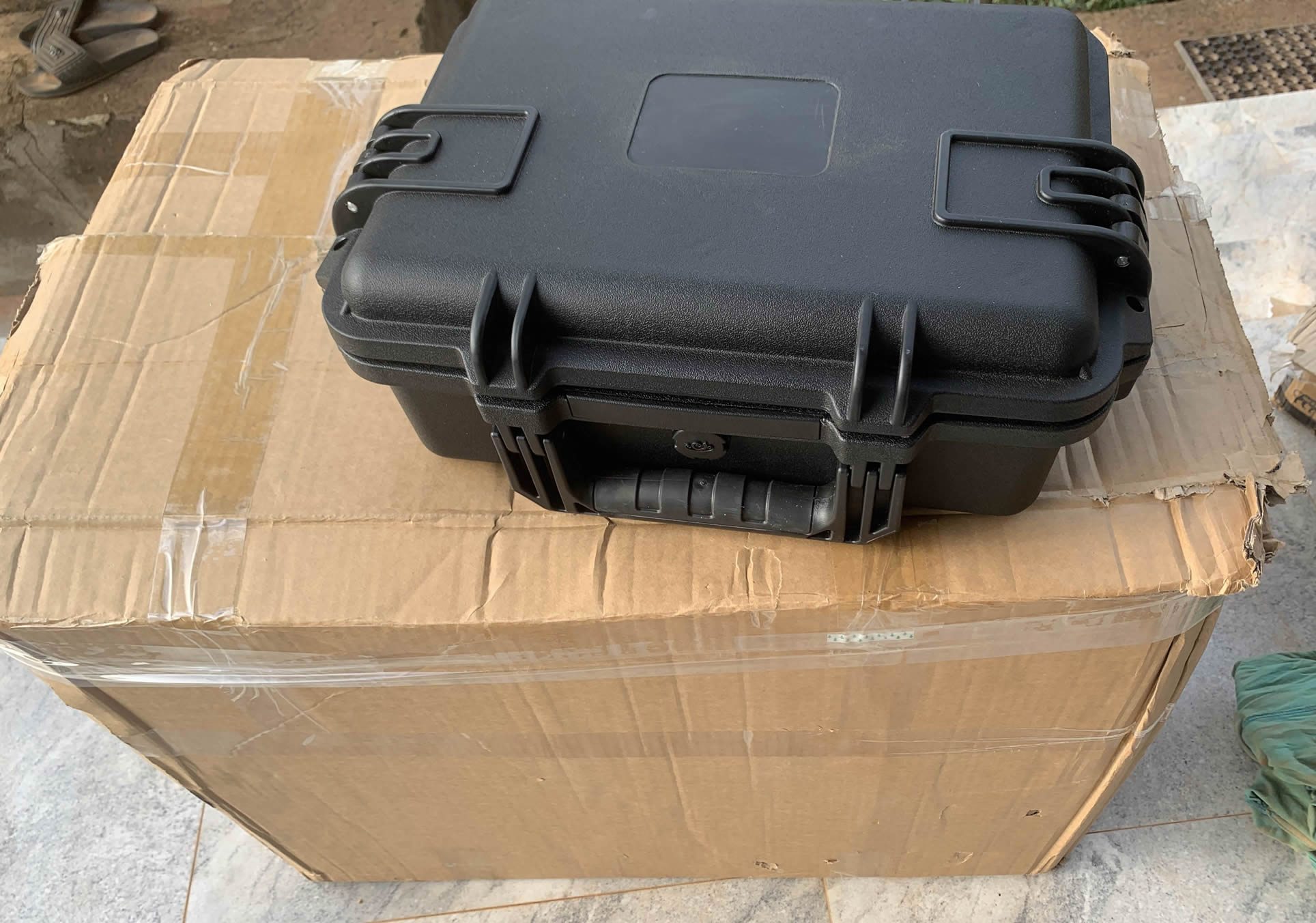
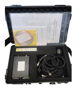
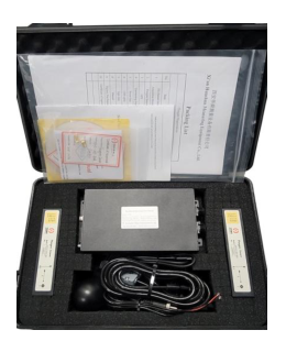
iSmart Terrameter field-ready IP65 configuration
iSmart Terrameter · field-ready configuration
Sake Innovations iSmart Terrameter
Designed and supplied by Sake Innovations & Technologies
01 — In the field

Measure, locate, and retain context.

The iSmart Terrameter supports electrical acquisition without separating the reading from its survey context. The applicable field arrangement is configured, current is injected, potential difference is measured, and location/time context can be retained through the mobile workflow.

Measurements
Potential difference and apparent resistivity inputs
Survey context
Location and timestamp where provided by the mobile workflow
Handoff format
Validated CSV for supported G-RES workflows
02 — The working path

One clear handoff from instrument to interpretation.

The current workflow is intentionally explicit. Direct synchronization is roadmap work and is not presented as live.

  1. 01

    Configure

    Prepare the applicable electrode arrangement and acquisition settings.

  2. 02

    Acquire

    Record field measurements with the available location and time context.

  3. 03 · Current handoff

    Validate CSV

    Check the exported structure before it enters the supported processing path.

  4. 04

    Process in G-RES

    Continue through the applicable VES, ERT, or induced-polarization workflow.

  5. 05

    Review and report

    Interpret the processed evidence and prepare the technical delivery.

03 — Integration state

Available now

CSV handoff into G-RES

Field teams export the iSmart dataset, validate its structure, and upload it into the applicable G-RES workflow. No direct synchronization is implied.

Product roadmap

A closer field-to-cloud path

  • Direct G-RES export
  • Mobile upload
  • Authenticated cloud synchronization
  • Near-real-time processing where appropriate
  • Streamlined review and reporting

Instrument availability

Start in the field with iSmart.

Sake Innovations manages configuration, accessories, specifications, availability, and ordering. Terracode can help plan the supported G-RES processing path.

Order an iSmart today
Terracode × Sake Innovations

Acquire in the field. Continue in G-RES.

A practical Nigerian hardware-and-software pathway for electrical geophysical surveys—from current injection and voltage measurement to structured processing, interpretation, and reporting.

Self PotentialResistivityInduced PolarizationERT
How acquisition works

Measured in the field, with survey context attached.

The iSmart Terrameter sends controlled current through field electrodes, measures the resulting voltage difference, and calculates apparent resistivity from the measurement geometry. Its mobile workflow adds GPS coordinates and timestamps to acquired data.

Configure the survey

Set the applicable SP, resistivity, IP, or ERT field arrangement and connect the control unit, electrodes, and cables.

Inject and measure

The instrument injects controlled current and records the potential difference at the receiving electrodes.

Retain field context

Measurements can carry mobile GPS and time stamps so the dataset remains connected to where and when it was acquired.

Export for technical work

The current Terracode handoff uses an exported CSV that is checked before entering the G-RES workflow.

Current state and roadmap

Clear about what works today—and what comes next.

Available now

Validated CSV handoff to G-RES

Teams acquire with iSmart, export the field dataset, validate its structure, and continue with the applicable VES, ERT, or IP processing workflow in G-RES.

  • Field acquisition remains controlled by the iSmart workflow
  • G-RES handles supported processing and interpretation paths
  • Outputs move into technical review and reporting
Planned integration

A closer field-to-cloud path

The partnership roadmap targets fewer manual handoffs without compromising numerical validation.

  • Direct G-RES export from the field workflow
  • Mobile upload and authenticated cloud synchronization
  • Near-real-time processing where method and connectivity allow
  • Streamlined, reviewable report generation
iSmart Terrameter in its field-ready IP65 enclosure
Field-ready iSmart Terrameter configuration · image supplied by Sake Innovations
Made in Nigeria

Hardware built close to the field problem.

Sake Innovations & Technologies manufactures the iSmart Terrameter in Nigeria. Product configurations, accessories, specifications, availability, and ordering are managed directly by Sake.

Order an iSmart today

404 · Outside the survey boundary

No record at this coordinate.

The route may have moved or never existed. Return to a known part of the Terracode system.

ROUTE NOT FOUND / 404
404 · Outside the survey boundary

This coordinate has no page.

The address may have moved or never existed. Return to a known Terracode route and continue from there.

Legal

Terms of Service

Legal

Privacy Policy

Legal

Cookie Policy

Legal

Acceptable Use Policy

Legal

Data Ownership and Confidentiality

Legal

AI and Third-Party Processing

Legal

Disclaimer and Limitation of Liability